
April 23, 2014
The Smithsonian Institution has a digital collection of 3D models of some of its objects, which expands the reach of its collection and also helps researchers.
The Smithsonian Institution has a digital collection of 3D models of some of its objects, which expands the reach of its collection and also helps researchers.
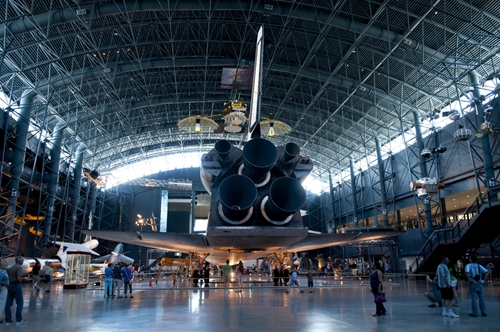
The Smithsonian Institution has a digital collection of 3D models of some of its objects, which expands the reach of its collection and also helps researchers.
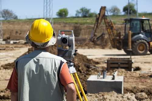
There are many reasons 3D laser scanning is so popular with land surveyors.
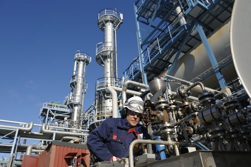
Whenever petrochemical and process services facilities consider expanding, they need to have an accurate view of each plant's equipment, machinery and pipelines to avoid leakages and other potential hazards from occurring.
By SPAR Point Group staff
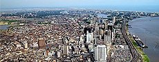
SmartGeoMetrics announced the latest opening of its new office on April 1, 2014 in Lagos, Nigeria. This location represents SmartGeoMetrics’ fifth worldwide, adding to offices in Houston, TX; Nashville, TN; Washington D.C.; and Port of Spain, Trinidad. The Nigerian operation is a joint venture between SmartGeoMetrics and Petroprism Limited, an indigenous Nigerian services firm. This location is staffed with a primary focus on the petrochemical sector, however, all of SmartGeoMetrics’ existing support services will be provided in addition to Petroprism’s core services including 3D imaging, modeling & visualization services, enterprise & industrial information systems, and expert manpower supply services.
SmartGeoMetrics Nigeria Contact Information
Ayodeji Akinrinmade, MBA PMP – Manager
123 T.F.Kuboye Road
Lekki Phase 1
Lagos State, Nigeria
Email: infong@smartgeometrics.com
Phone: +234 802 222 1918
Website: www.smartgeometrics.com
Petroprism Limited, an indigenous Nigerian professional services consultancy, providing engineering support services and technology solutions for the design, construction and operation of Oil & Gas infrastructure assets. Petroprism is led by experienced Nigerian professionals and supported by a network of domain knowledge experts in the Oil and Gas industry.
SmartGeoMetrics™ is a 3D Imaging and Support Services company providing equipment rental, hardware and software sales, training and experienced market-focused support services on an international level. Our laser scanner inventory is the largest in the industry including the latest Leica 3D Laser scanners, targets, hi-res digital panoramic camera gear and a full-range of accessories. SmartGeoMetrics is dedicated to providing products and services that generate the greatest possible return on investment for our customers. We utilize our experience in the industry to seek and provide technologies that will add a competitive advantage to those who invest with us. Accordingly, all services are accomplished in an efficient and professional manner, always respecting the time and resources of our customers.
The steamer Robert J. Walker will once more be raised from the bottom of the ocean thanks to 3D laser scanning.

Businesses lose out on opportunities for greater accuracy and more point data because they don't find the best tool for the job.

The collapse of a historic bridge in Texas could have been avoided with the help of 3D laser scanning.

When there's not much funding to repair infrastructure, engineers need to be sure they are using their available resources in the best ways.

When there's not much funding to repair infrastructure, engineers need to be sure they are using their available resources in the best ways.